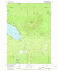
1967 Map of Odell Lake
USGS Topo · Published 1981About this map
Southern Pacific rail lines trace the southern shoreline of Odell Lake, a central landmark in this 1960s survey of the high cascades. The map documents the recreational infrastructure of the Deschutes National Forest during its postwar expansion, including the Odell Lake Resort and several established sites like Sunset Cove Campground and Odell Creek Campground. Further south, the map details the community at Crescent Lake, where a Crescent Lake Landing Strip and a Gravel Pit indicate localized development and transit.
Find a feature on this map
52 named features on this map. Tap any name to fly to it.
Don’t see what you’re looking for? This feature index may not catch every label — zoom into the map to look around manually.
Map Details
Editions of this 1967 Odell Lake Map
This is the sole edition of this map. No revisions or reprints were ever made.
Other maps of this area

1917 · Diamond Lake
USGS Topo · 1:125,000

1925 · Waldo Lake
USGS Topo · 1:125,000

1930 · Maiden Peak
USGS Topo · 1:125,000

1934 · Maiden Peak
USGS Topo · 1:125,000

1935 · Chemult
USGS Topo · 1:96,000

1941 · Chemult
USGS Topo · 1:125,000

1955 · Crescent
USGS Topo · 1:250,000

1956 · Waldo Lake
USGS Topo · 1:62,500

1956 · Summit Lake
USGS Topo · 1:62,500

1957 · Crescent
USGS Topo · 1:250,000