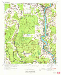
1970 Map of Odenburg
USGS Topo · Published 1972About this map
The complex hydrology of the Atchafalaya Basin dominates this landscape, where the West Atchafalaya Floodway creates a massive path for water between the Bayou des Glaises and the main channel of the Atchafalaya River. In the early 1970s, this region remained a patchwork of riverfront settlements and isolated bayou crossings. Simmesport sits at a critical junction of the Texas and Pacific Railroad and the Louisiana and Arkansas Railroad, serving as a gateway to the fertile but flood-prone lands of the Avoyelles Parish.
Find a feature on this map
89 named features on this map. Tap any name to fly to it.
Don’t see what you’re looking for? This feature index may not catch every label — zoom into the map to look around manually.
Map Details
Editions of this 1970 Odenburg Map
This is the sole edition of this map. No revisions or reprints were ever made.
Other maps of this area

1939 · Opelousas
USGS Topo · 1:62,500

1939 · Artonish
USGS Topo · 1:62,500

1939 · Fordoche
USGS Topo · 1:62,500

1940 · Marksville
USGS Topo · 1:62,500

1941 · Voorhies
USGS Topo · 1:62,500

1941 · Batchelor
USGS Topo · 1:62,500

1948 · Bunkie
USGS Topo · 1:62,500

1952 · Lake Charles
USGS Topo · 1:250,000

1953 · Alexandria
USGS Topo · 1:250,000

1953 · Natchez
USGS Topo · 1:250,000