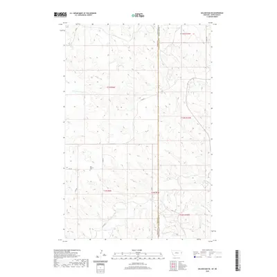
2020 Map of Odland Dam NE
USGS Topo · Published 2020About this map
Blue Mountain rises as a prominent landmark in this borderland where the western edge of Golden Valley County, North Dakota, meets Wibaux County, Montana. The terrain is defined by a sparse network of section-line roads and seasonal watercourses, including the N Fork Cottonwood Cr and Beaver Cr. This high plains landscape is notably centered around Blue Mountain Cem, a key point of interest for genealogists tracing early settlement families in this remote corner of the state. The infrastructure is characterized by essential transit routes such as Divide Rd and Hwy 261, which navigate the undulating topography. The map illustrates the persistent layout of township and range divisions, capturing the enduring rural character and the geographic isolation typical of the North Dakota-Montana state line region.
Find a feature on this map
19 named features on this map. Tap any name to fly to it.
Don’t see what you’re looking for? This feature index may not catch every label — zoom into the map to look around manually.
Map Details
Editions of this 2020 Odland Dam NE Map
This is the sole edition of this map. No revisions or reprints were ever made.
Other maps of this area

1909 · Glendive
USGS Topo · 1:250,000

1953 · Watford City
USGS Topo · 1:250,000

1954 · Glendive
USGS Topo · 1:250,000

1957 · Glendive
USGS Topo · 1:250,000

1957 · Watford City
USGS Topo · 1:250,000

1958 · Glendive
USGS Topo · 1:250,000

1967 · Watford City
USGS Topo · 1:250,000

1974 · Hootowl Creek West
USGS Topo · 1:24,000

1974 · Trotters
USGS Topo · 1:24,000
1974 · Skaar
USGS Topo · 1:24,000