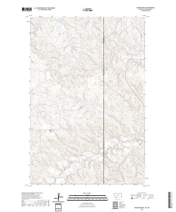
2024 Map of Odland Dam NE
USGS Topo · Published 2024About this map
The Montana-North Dakota state line bisects this high plains landscape, marking the boundary between Wibaux County and Golden Valley County. A sparse network of section roads and cattle trails defines the human footprint here, with Divide Rd and W Bar Rd following the natural contours of the terrain. Near the intersection of Bell Rd and Divide Rd, the Blue Mountain Cem serves as a small but significant landmark for local genealogy and history researchers. The drainage patterns of Beaver Creek and Dry Creek dominate the southern portion of the quadrangle, illustrating the complex erosion of the prairie breaks. This map details the Public Land Survey System grids, including t17n r60e and t143n r105w, which organized the settlement of these borderlands.
Find a feature on this map
17 named features on this map. Tap any name to fly to it.
Don’t see what you’re looking for? This feature index may not catch every label — zoom into the map to look around manually.
Map Details
Editions of this 2024 Odland Dam NE Map
This is the sole edition of this map. No revisions or reprints were ever made.
Other maps of this area

1909 · Glendive
USGS Topo · 1:250,000

1953 · Watford City
USGS Topo · 1:250,000

1954 · Glendive
USGS Topo · 1:250,000

1957 · Glendive
USGS Topo · 1:250,000

1957 · Watford City
USGS Topo · 1:250,000

1958 · Glendive
USGS Topo · 1:250,000

1967 · Watford City
USGS Topo · 1:250,000

1974 · Hootowl Creek West
USGS Topo · 1:24,000

1974 · Trotters
USGS Topo · 1:24,000
1974 · Skaar
USGS Topo · 1:24,000