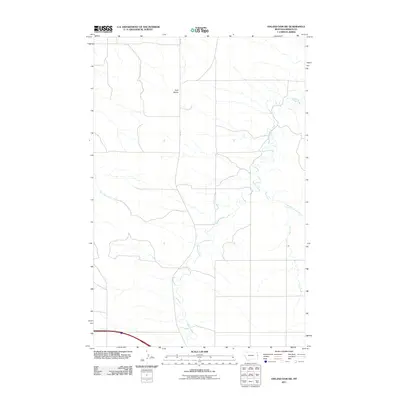
2011 Map of Odland Dam SW
USGS Topo · Published 2011About this map
Beaver Creek meanders through this landscape in eastern Wibaux County, defining the drainage patterns of a sparsely populated agricultural region. The high ground of Four Buttes stands as a prominent topographical landmark north of the creek, while Rte 261 provides the primary north-south passage through the area. Several tributaries, including Hay Creek, its East Branch Hay Creek, and Box Elder Creek, create a complex network of coulees and draws typical of the Missouri Plateau. This 2011 survey documents the rural character of the Montana plains at the start of the second decade of the 21st century, showing the enduring ranching and farming roads that connect isolated homesteads to the broader county infrastructure.
Find a feature on this map
6 named features on this map. Tap any name to fly to it.
Don’t see what you’re looking for? This feature index may not catch every label — zoom into the map to look around manually.
Map Details
Editions of this 2011 Odland Dam SW Map
This is the sole edition of this map. No revisions or reprints were ever made.
Other maps of this area

1909 · Glendive
USGS Topo · 1:250,000

1953 · Miles City
USGS Topo · 1:250,000

1954 · Glendive
USGS Topo · 1:250,000

1957 · Miles City
USGS Topo · 1:250,000

1957 · Glendive
USGS Topo · 1:250,000

1958 · Miles City
USGS Topo · 1:250,000

1958 · Glendive
USGS Topo · 1:250,000
1974 · Odland Dam
USGS Topo · 1:24,000
1974 · Odland Dam NE
USGS Topo · 1:24,000

1981 · Glendive
USGS Topo · 1:100,000