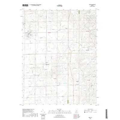
2019 Map of Odon
USGS Topo · Published 2019About this map
Odon serves as the primary hub of this agricultural and creek-cut landscape along the border of Daviess and Martin Counties. The layout reflects a deeply established rural community, organized by an extensive grid of county roads such as Co RD 1400 N and Buffalo Trl, which connect small clusters like Farlen, Raglesville, and Bramble. For genealogists and local researchers, the area is rich with family and community landmarks, including Walnut Hill Cem, Kilgore Cem, and Saint Joseph Cem.
Find a feature on this map
58 named features on this map. Tap any name to fly to it.
Don’t see what you’re looking for? This feature index may not catch every label — zoom into the map to look around manually.
Map Details
Editions of this 2019 Odon Map
This is the sole edition of this map. No revisions or reprints were ever made.
Other maps of this area

1943 · Lyons
USGS Topo · 1:24,000

1943 · Epsom
USGS Topo · 1:24,000

1944 · Montgomery
USGS Topo · 1:24,000

1950 · Shoals
USGS Topo · 1:24,000

1950 · Odon
USGS Topo · 1:24,000

1956 · Loogootee
USGS Topo · 1:24,000

1956 · Koleen
USGS Topo · 1:24,000

1956 · Indian Springs
USGS Topo · 1:24,000

1956 · Vincennes
USGS Topo · 1:250,000

1957 · Vincennes
USGS Topo · 1:250,000