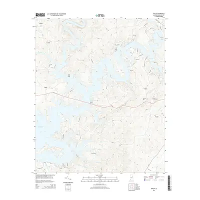
2014 Map of Ofelia
USGS Topo · Published 2014About this map
R L Harris Reservoir dominates this Randolph County landscape, where the rising waters of the Tallapoosa River branch into numerous inlets and flooded creek beds. The 2014 terrain shows the intricate shoreline surrounding Ofelia and the western outskirts of Wedowee, reflecting a region defined by modern water management and recreational development. High points like Cockrell Mtn provide a vertical contrast to the winding river valleys of Mad Indian Creek and the Little Tallapoosa River.
Find a feature on this map
89 named features on this map. Tap any name to fly to it.
Don’t see what you’re looking for? This feature index may not catch every label — zoom into the map to look around manually.
Map Details
Editions of this 2014 Ofelia Map
This is the sole edition of this map. No revisions or reprints were ever made.
Other maps of this area

1891 · Ashland
USGS Topo · 1:125,000

1899 · Wedowee
USGS Topo · 1:125,000

1902 · Wedowee
USGS Topo · 1:125,000

1953 · Atlanta
USGS Topo · 1:250,000

1957 · Atlanta
USGS Topo · 1:250,000

1958 · Atlanta
USGS Topo · 1:250,000

1969 · Wadley North
USGS Topo · 1:24,000
1969 · Newell
USGS Topo · 1:24,000
1969 · Wedowee
USGS Topo · 1:24,000

1969 · Mellow Valley
USGS Topo · 1:24,000