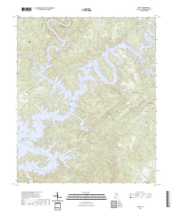
2024 Map of Ofelia
USGS Topo · Published 2024About this map
The Tallapoosa River and its intricate drainage network define the topography of this Randolph County landscape, where the waters of the R L Harris Reservoir reach into the winding valleys. The map documents a transition between upland ridges and the encroaching backwaters of the reservoir system, centered on the small settlement of Ofelia. Historically significant river crossings are well-preserved in the record, including legacy locations for Butlers Ferry, Burrow Ferry, and Blake Ferry, along with traditional river crossings at Brown Ford and Michels Ford.
Find a feature on this map
113 named features on this map. Tap any name to fly to it.
Don’t see what you’re looking for? This feature index may not catch every label — zoom into the map to look around manually.
Map Details
Editions of this 2024 Ofelia Map
This is the sole edition of this map. No revisions or reprints were ever made.
Other maps of this area

1891 · Ashland
USGS Topo · 1:125,000

1899 · Wedowee
USGS Topo · 1:125,000

1902 · Wedowee
USGS Topo · 1:125,000

1953 · Atlanta
USGS Topo · 1:250,000

1957 · Atlanta
USGS Topo · 1:250,000

1958 · Atlanta
USGS Topo · 1:250,000

1969 · Wadley North
USGS Topo · 1:24,000
1969 · Newell
USGS Topo · 1:24,000
1969 · Wedowee
USGS Topo · 1:24,000

1969 · Mellow Valley
USGS Topo · 1:24,000