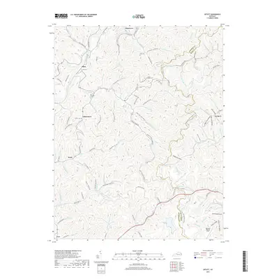
2019 Map of Offutt
USGS Topo · Published 2019About this map
Butcher Hollow serves as a focal point in this eastern Kentucky landscape, where the deeply carved drainages of the Appalachian Plateau define the region's character and settlement patterns. Located along the border of Johnson Co and Martin Co, the area is punctuated by small, creek-side communities like Whitehouse, Offutt, and Williamsport. The map reveals a dense network of hollows such as Deadening Hollow and Slate Hollow, illustrating how local topography has historically dictated the winding path of roads like Greasy Creek Rd and the placement of family burial grounds. Notable sites including the Ballard Butcher Cem and Ward Cem offer valuable landmarks for genealogical research. To the south, the terrain transitions toward the Big Sandy Regional Airport, contrasting the traditional coal-country settlement style with modern regional infrastructure. This survey captures a moment in time where old timber and mining access routes, such as the Spring Knob Lookout Tower Rd, meet established rural homesteads.
Find a feature on this map
118 named features on this map. Tap any name to fly to it.
Don’t see what you’re looking for? This feature index may not catch every label — zoom into the map to look around manually.
Map Details
Editions of this 2019 Offutt Map
This is the sole edition of this map. No revisions or reprints were ever made.
Other maps of this area

1886 · Prestonsburg
USGS Topo · 1:125,000

1892 · Prestonsburg
USGS Topo · 1:125,000

1914 · Laynesville
USGS Topo · 1:48,000

1914 · Inez
USGS Topo · 1:48,000

1915 · Paintsville
USGS Topo · 1:48,000

1915 · Prestonsburg
USGS Topo · 1:62,500

1916 · Harold
USGS Topo · 1:62,500

1916 · Inez
USGS Topo · 1:62,500

1917 · Paintsville
USGS Topo · 1:62,500

1918 · Prestonsburg
USGS Topo · 1:62,500