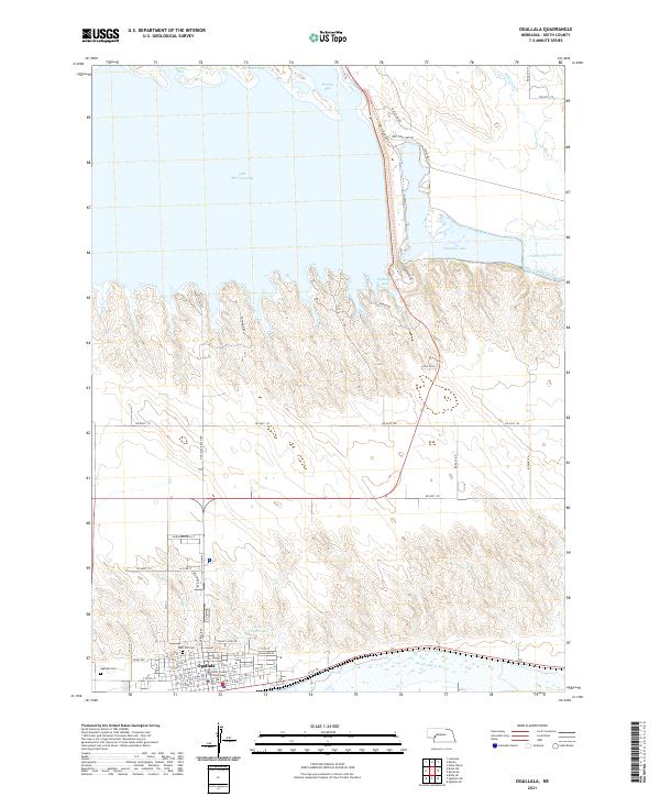
2021 Map of Ogallala
USGS Topo · Published 2021About this map
The Keith County Courthouse and the historic Boot Hill Cem anchor the town of Ogallala in this 2021 survey, which illustrates the modern landscape of the western Nebraska plains. Situated between the North Platte River and the South Platte River, the area is defined by massive water management infrastructure, most notably the eastern end of Lake McConaughy and the adjacent Ogallala Lake.
Find a feature on this map
55 named features on this map. Tap any name to fly to it.
Don’t see what you’re looking for? This feature index may not catch every label — zoom into the map to look around manually.
Map Details
Editions of this 2021 Ogallala Map
This is the sole edition of this map. No revisions or reprints were ever made.
Other maps of this area

1897 · Ogallala
USGS Topo · 1:125,000

1900 · Ogallala
USGS Topo · 1:125,000

1954 · North Platte
USGS Topo · 1:250,000

1956 · North Platte
USGS Topo · 1:250,000

1957 · North Platte
USGS Topo · 1:250,000
1961 · Brule SE
USGS Topo · 1:24,000

1967 · North Platte
USGS Topo · 1:250,000

1971 · Martin
USGS Topo · 1:24,000
1971 · Ogallala SW
USGS Topo · 1:24,000
1971 · Ogallala SE
USGS Topo · 1:24,000