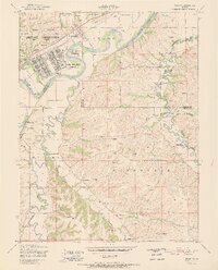
1951 Map of Ogden
USGS Topo · Published 1951About this map
Camp Funston and the Fort Riley Military Reservation dominate the northwestern landscape of this mid-century survey, revealing a sprawling complex of barracks, rifle ranges, and training grounds during the early Cold War era. Situated along the Kansas River, the area is a study in military expansion and traditional rural life. The Union Pacific railroad tracks parallel the river, serving as a primary corridor through the hills of Jefferson and Wingfield.
Find a feature on this map
37 named features on this map. Tap any name to fly to it.
Don’t see what you’re looking for? This feature index may not catch every label — zoom into the map to look around manually.
Map Details
Editions of this 1951 Ogden Map
2 editions found

Other maps of this area

1886 · Junction City
USGS Topo · 1:125,000

1889 · Junction City
USGS Topo · 1:125,000

1889 · Parkerville
USGS Topo · 1:125,000

1894 · Junction City
USGS Topo · 1:125,000

1894 · Parkerville
USGS Topo · 1:125,000

1947 · Manhattan
USGS Topo · 1:62,500

1947 · Fort Riley
USGS Topo · 1:62,500

1950 · Keats
USGS Topo · 1:24,000

1950 · Manhattan
USGS Topo · 1:24,000

1950 · Junction City
USGS Topo · 1:24,000