
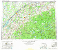
1948 Map of Ogdensburg
USGS Topo · Published 1973About this map
The St Lawrence River serves as the central artery of this international border region, connecting major New York hubs like Ogdensburg and Massena with Ontario settlements such as Brockville and Prescott. This late 1940s landscape is defined by its educational and institutional anchors, including St Lawrence University in Canton and the Clarkson College of Technology in Potsdam. Further south, the Adirondack Mountains rise sharply, featuring landmarks like Whiteface Mountain and Mount Marcy, while the wilderness of Adirondack Park is dotted with numerous water bodies like Cranberry Lake and Upper Saranac Lake.
Find a feature on this map
286 named features on this map. Tap any name to fly to it.
Don’t see what you’re looking for? This feature index may not catch every label — zoom into the map to look around manually.
Map Details
Editions of this 1948 Ogdensburg Map
2 editions found
Other maps of this area

1893 · Sackets Harbor
USGS Topo · 1:62,500

1895 · Sacketts Harbor
USGS Topo · 1:62,500

1895 · Mt. Marcy
USGS Topo · 1:62,500

1895 · Watertown
USGS Topo · 1:62,500

1896 · Lake Placid
USGS Topo · 1:62,500

1897 · Schroon Lake
USGS Topo · 1:62,500

1898 · Newcomb
USGS Topo · 1:62,500

1898 · Lake Placid
USGS Topo · 1:62,500

1898 · Watertown
USGS Topo · 1:62,500

1900 · Clayton
USGS Topo · 1:62,500