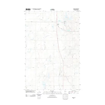
2013 Map of Ogema
USGS Topo · Published 2013About this map
The settlement of Ogema serves as the focal point for this section of Becker County, Minnesota, situated along the north-south corridor of Us-59. This landscape is defined by its glacial till and abundant water bodies, ranging from smaller potholes to larger basins like Lemon Lake and Baker Lake. The hydrology is complex, featuring the meandering S Br Wild Rice River in the central portion and the Buffalo River flowing across the southern reaches toward Trotterchaud Lake. Local family history is rooted in the surrounding prairie and farmland, evidenced by the Groth Farm to the northwest. For genealogists, the map identifies significant burial sites including the Ogema Cem and the Most Holy Redeemer Cem, which reflect the community's early cultural and religious foundations. The network of township roads, such as Steffl Rd and Donley Rd, delineates a structured agricultural grid typical of the region's development.
Find a feature on this map
36 named features on this map. Tap any name to fly to it.
Don’t see what you’re looking for? This feature index may not catch every label — zoom into the map to look around manually.
Map Details
Editions of this 2013 Ogema Map
This is the sole edition of this map. No revisions or reprints were ever made.
Other maps of this area

1918 · Flom
USGS Topo · 1:62,500

1952 · Grand Forks
USGS Topo · 1:250,000

1953 · Fargo
USGS Topo · 1:250,000

1953 · Brainerd
USGS Topo · 1:250,000

1954 · Bemidji
USGS Topo · 1:250,000

1956 · Fargo
USGS Topo · 1:250,000

1956 · Grand Forks
USGS Topo · 1:250,000

1957 · Brainerd
USGS Topo · 1:250,000

1957 · Bemidji
USGS Topo · 1:250,000

1958 · Bemidji
USGS Topo · 1:250,000