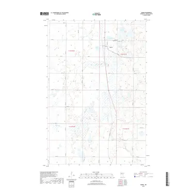
2019 Map of Ogema
USGS Topo · Published 2019About this map
Ogema serves as the central hub of this Becker County landscape, where the local Po and surrounding street grid meet the glacial topography of the White Earth Reservation area. The village is flanked by significant local landmarks, including the Most Holy Redeemer Cem and Ogema Cem to the north. This 2019 survey documents a complex hydrological network where the S Br Wild Rice River and the Buffalo River navigate through numerous wetlands and smaller basins like Otto Lake and Baker Lake. The density of smaller water bodies such as Dump Ground Lake and Morrison Lake illustrates the post-glacial drift prairie character of the region. A robust network of section-line roads, including Co Rd 18 and Town Hall Rd, connects the scattered farmsteads and rural properties throughout the townships.
Find a feature on this map
34 named features on this map. Tap any name to fly to it.
Don’t see what you’re looking for? This feature index may not catch every label — zoom into the map to look around manually.
Map Details
Editions of this 2019 Ogema Map
This is the sole edition of this map. No revisions or reprints were ever made.
Other maps of this area
1918 · Flom
USGS Topo · 1:62,500

1952 · Grand Forks
USGS Topo · 1:250,000

1953 · Fargo
USGS Topo · 1:250,000

1953 · Brainerd
USGS Topo · 1:250,000

1954 · Bemidji
USGS Topo · 1:250,000

1956 · Fargo
USGS Topo · 1:250,000

1956 · Grand Forks
USGS Topo · 1:250,000

1957 · Brainerd
USGS Topo · 1:250,000

1957 · Bemidji
USGS Topo · 1:250,000

1958 · Bemidji
USGS Topo · 1:250,000