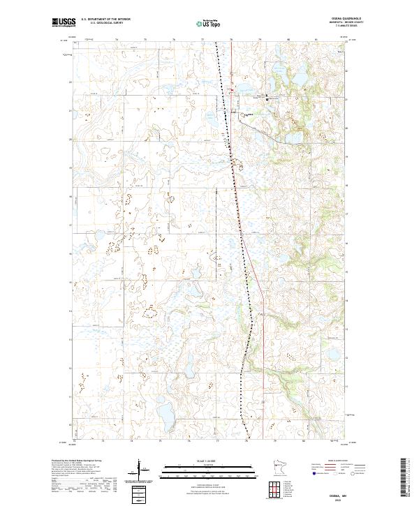
2022 Map of Ogema
USGS Topo · Published 2022About this map
Ogema serves as the central hub of this landscape, a community defined by its proximity to the glacial kettle lakes and wetland corridors of western Minnesota. The settlement pattern is anchored by essential local landmarks including the Most Holy Redeemer Cem, Ogema Cem, and the town's Post Office. The surrounding terrain is characterized by a dense network of water bodies, most notably Ogema Lake, Baker Lake, and the uniquely named Dump Ground Lake. These waters drain into significant regional arteries such as the S Br Wild Rice River and the Buffalo River. The map details a transition from the structured residential grid of the village to the expansive rural sections divided by thoroughfares like Co Rd 34 and Town Hall Rd, illustrating the intersection of natural hydrology and human surveying in Becker County.
Find a feature on this map
30 named features on this map. Tap any name to fly to it.
Don’t see what you’re looking for? This feature index may not catch every label — zoom into the map to look around manually.
Map Details
Editions of this 2022 Ogema Map
This is the sole edition of this map. No revisions or reprints were ever made.
Other maps of this area

1918 · Flom
USGS Topo · 1:62,500

1952 · Grand Forks
USGS Topo · 1:250,000

1953 · Fargo
USGS Topo · 1:250,000

1953 · Brainerd
USGS Topo · 1:250,000

1954 · Bemidji
USGS Topo · 1:250,000

1956 · Fargo
USGS Topo · 1:250,000

1956 · Grand Forks
USGS Topo · 1:250,000

1957 · Brainerd
USGS Topo · 1:250,000

1957 · Bemidji
USGS Topo · 1:250,000

1958 · Bemidji
USGS Topo · 1:250,000