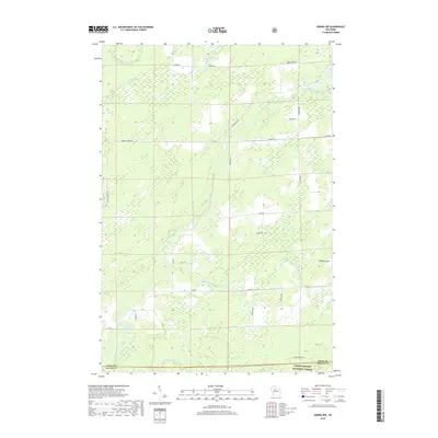
2018 Map of Ogema NW
USGS Topo · Published 2018About this map
The Chequamegon National Forest anchors this portion of northern Wisconsin, where the topography is defined by the convergence of several significant waterways. Both the North Fork Jump River and the South Fork Jump River wind through the township, joined by smaller tributaries like Hobbles Cr and Little Mondeaux Cr. This 2018 survey illustrates a landscape primarily managed for timber and conservation, marked by a systematic grid of forest roads and fire lanes. Notable high ground includes Hallberg Hill, while the boundary between Price and Taylor counties is clearly delineated across the southern edge of the sheet. The network of local routes, such as Catawba Fire Ln and Shimon Rd, provides access into the dense forest interior and towards the Mondeaux River headwaters, reflecting the area's ongoing identity as a remote timberland and recreational resource.
Find a feature on this map
29 named features on this map. Tap any name to fly to it.
Don’t see what you’re looking for? This feature index may not catch every label — zoom into the map to look around manually.
Map Details
Editions of this 2018 Ogema NW Map
This is the sole edition of this map. No revisions or reprints were ever made.
Other maps of this area

1941 · Kennan
USGS Topo · 1:48,000

1941 · Phillips
USGS Topo · 1:48,000

1943 · Philliips
USGS Topo · 1:48,000

1944 · Ogema
USGS Topo · 1:48,000

1945 · Kennan
USGS Topo · 1:48,000

1945 · Black River
USGS Topo · 1:48,000

1947 · Ogema
USGS Topo · 1:48,000

1949 · Ogema
USGS Topo · 1:48,000

1949 · Jump River Fire Tower
USGS Topo · 1:48,000

1953 · Rice Lake
USGS Topo · 1:250,000