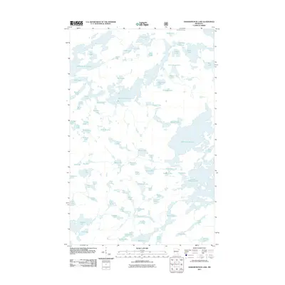
2011 Map of Ogishkemuncie Lake
USGS Topo · Published 2011About this map
Ogishkemuncie Lake sits at the heart of this intricate aquatic landscape, part of a dense network of glacial water bodies in Cook County. The map shows a region defined by complex shorelines and interconnected basins, including the sprawling Gabimichigami Lake and the elongated South Arm Knife Lake. This 2011 survey records the hydrography of a wilderness area where land and water are inextricably linked, with smaller features like Spice Lake, Eddy Lake, and the curiously named Skindance Lake filling the spaces between larger catchments. The absence of roads or developed infrastructure emphasizes the primitive character of the terrain, where travel is dictated by the portages and passages between names like Agamok Lake and Mueller Lake. For those studying the geography of northern Minnesota, this map provides a detailed view of the natural drainage patterns and the specific placement of landmarks such as Kekekabic Ponds and Jasper Lake.
Find a feature on this map
79 named features on this map. Tap any name to fly to it.
Don’t see what you’re looking for? This feature index may not catch every label — zoom into the map to look around manually.
Map Details
Editions of this 2011 Ogishkemuncie Lake Map
This is the sole edition of this map. No revisions or reprints were ever made.
Other maps of this area

1954 · Two Harbors
USGS Topo · 1:250,000

1957 · Two Harbors
USGS Topo · 1:250,000

1957 · Quetico
USGS Topo · 1:250,000

1958 · Two Harbors
USGS Topo · 1:250,000

1959 · Munker Island
USGS Topo · 1:24,000

1959 · Ogishkemuncie Lake
USGS Topo · 1:24,000

1959 · Kekekabic Lake
USGS Topo · 1:24,000

1959 · Dutton Lake
USGS Topo · 1:24,000

1959 · Gillis Lake
USGS Topo · 1:24,000

1959 · Ester Lake
USGS Topo · 1:24,000