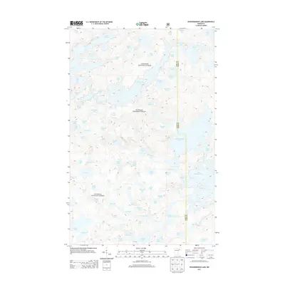
2013 Map of Ogishkemuncie Lake
USGS Topo · Published 2013About this map
Superior National Forest defines this northern landscape, where the border between Lake and Cook counties intersects a dense network of glacial water bodies. This 2013 survey provides a detailed look at the hydrology and topographical relief of the Boundary Waters region, showing the intricate connections between names like S Arm Knife Lake, Kekekabic Ponds, and Mugwump Lake. The terrain is characterized by steep ridges and depressions that create distinct drainage patterns, evident in the positioning of smaller basins like Topaz Lake and Ledge Lake. For those interested in the preservation of wilderness areas, the map documents the established boundaries and remote topography that remain largely untouched by modern development. This detailed study allows for a precise examination of the natural corridors and shoreline configurations of Eddy Lake and Calico Lake, reflecting the enduring character of the Minnesota wilderness.
Find a feature on this map
82 named features on this map. Tap any name to fly to it.
Don’t see what you’re looking for? This feature index may not catch every label — zoom into the map to look around manually.
Map Details
Editions of this 2013 Ogishkemuncie Lake Map
This is the sole edition of this map. No revisions or reprints were ever made.
Other maps of this area

1954 · Two Harbors
USGS Topo · 1:250,000

1957 · Two Harbors
USGS Topo · 1:250,000

1957 · Quetico
USGS Topo · 1:250,000

1958 · Two Harbors
USGS Topo · 1:250,000

1959 · Munker Island
USGS Topo · 1:24,000

1959 · Ogishkemuncie Lake
USGS Topo · 1:24,000

1959 · Kekekabic Lake
USGS Topo · 1:24,000

1959 · Dutton Lake
USGS Topo · 1:24,000

1959 · Gillis Lake
USGS Topo · 1:24,000

1959 · Ester Lake
USGS Topo · 1:24,000