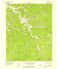
1954 Map of Ogle
USGS Topo · Published 1955About this map
Goose Creek defines the northern reaches of this mid-century survey of Clay County, where the landscape is carved by a dense network of branches and hollows. The settlement pattern follows these watercourses, with communities like Gooserock and Brightshade serving as local hubs for the surrounding timber and mountain farming families. Education in the mid-1950s was deeply localized, evidenced by the high density of small rural schools such as Billys Branch Sch, Martins Creek Sch, and Lower Otter Sch situated at narrow valley confluences. The southern boundary reveals the divide between the Clay Co and Knox Co lines, crossing through the headwaters of Lick Log Fork and Groundhog Hollow. Distinctive landmarks like Tater Knob and the Swafford Ch anchor the community geography of this remote Kentucky mountain district.
Find a feature on this map
69 named features on this map. Tap any name to fly to it.
Don’t see what you’re looking for? This feature index may not catch every label — zoom into the map to look around manually.
Map Details
Editions of this 1954 Ogle Map
2 editions found
Other maps of this area

1886 · Cumberland Gap
USGS Topo · 1:125,000

1888 · Cumberland Gap
USGS Topo · 1:125,000

1891 · Manchester
USGS Topo · 1:125,000

1891 · Cumberland Gap
USGS Topo · 1:125,000

1903 · Pineville
USGS Topo · 1:48,000

1952 · Hima
USGS Topo · 1:24,000

1952 · Fount
USGS Topo · 1:24,000

1952 · Manchester
USGS Topo · 1:24,000

1953 · Big Creek
USGS Topo · 1:24,000

1954 · Barcreek
USGS Topo · 1:24,000