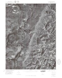
1977 Map of Ogletown
USGS Topo · Published 1979About this map
Shade Mountain dominates the northwestern terrain of this orthophotoquad, which captures the rural landscape of Bedford County in the late 1970s. The imagery reveals a stark contrast between the heavily forested ridges and the patterned agricultural clearings near the settlement of Ryot in the southeast. This 1:24,000 scale aerial perspective, produced in cooperation with the Soil Conservation Service, provides an exact visual record of land use and timber cover. Near the crossroads of Ogletown, the small reservoir of Pine Lake and the winding course of Clear Creek illustrate the water resources vital to this upland region. The absence of heavy industrial development or dense suburban expansion emphasizes the area's enduring reliance on the mountain and the meadow.
Find a feature on this map
5 named features on this map. Tap any name to fly to it.
Don’t see what you’re looking for? This feature index may not catch every label — zoom into the map to look around manually.
Map Details
Editions of this 1977 Ogletown Map
This is the sole edition of this map. No revisions or reprints were ever made.
Other maps of this area

1902 · Ebensburg
USGS Topo · 1:62,500

1904 · Ebensburg
USGS Topo · 1:62,500

1904 · Johnstown
USGS Topo · 1:62,500

1907 · Johnstown
USGS Topo · 1:62,500

1908 · Bedford
USGS Topo · 1:62,500

1910 · Bedford
USGS Topo · 1:62,500

1914 · Windber
USGS Topo · 1:62,500

1916 · Windber
USGS Topo · 1:62,500

1944 · Windber
USGS Topo · 1:62,500

1953 · Pittsburgh
USGS Topo · 1:250,000