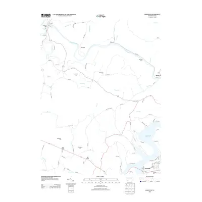
2013 Map of Ohiopyle
USGS Topo · Published 2013About this map
The Youghiogheny River carves a dramatic path through this section of Fayette County, creating the distinctive Horseshoe Bend and the Ohiopyle Gorge. Much of the northern landscape is dedicated to Ohiopyle State Park, where the river drops over Ohiopyle Falls near the town of Ohiopyle. The terrain is defined by significant elevations such as Sugarloaf Knob, which features the Sugarloaf Fire Tower, and Woodcock Hill further south.
Find a feature on this map
98 named features on this map. Tap any name to fly to it.
Don’t see what you’re looking for? This feature index may not catch every label — zoom into the map to look around manually.
Map Details
Editions of this 2013 Ohiopyle Map
This is the sole edition of this map. No revisions or reprints were ever made.
Other maps of this area

1900 · Accident
USGS Topo · 1:62,500

1900 · Uniontown
USGS Topo · 1:62,500

1904 · Bruceton
USGS Topo · 1:62,500

1922 · Confluence
USGS Topo · 1:62,500

1926 · Bruceton
USGS Topo · 1:62,500

1931 · Uniontown
USGS Topo · 1:62,500

1931 · Confluence
USGS Topo · 1:62,500

1931 · Bruceton Mills
USGS Topo · 1:62,500

1933 · Confluence
USGS Topo · 1:62,500

1933 · Bruceton
USGS Topo · 1:62,500
Featured Places
- Ohiopyle, PA
- Lower Turkeyfoot Township, PA
- Henry Clay Township, PA
- Wharton Township, PA
- Addison Township, PA