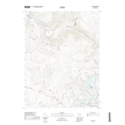
2019 Map of Ohiopyle
USGS Topo · Published 2019About this map
Ohiopyle Falls and the dramatic Horseshoe Bend anchor this 2019 survey of the Youghiogheny River corridor. The landscape is defined by the deep Ohiopyle Gorge and the heights of Laurel Hill and Sugarloaf Knob, with the Potomac Heritage National Scenic Trail winding through the steep terrain. Settlement patterns reflect the area's transition from early river-crossing and farming sites to a protected natural landscape, with several small communities like Victoria and Bidwell situated along the water's path.
Find a feature on this map
89 named features on this map. Tap any name to fly to it.
Don’t see what you’re looking for? This feature index may not catch every label — zoom into the map to look around manually.
Map Details
Editions of this 2019 Ohiopyle Map
This is the sole edition of this map. No revisions or reprints were ever made.
Other maps of this area

1900 · Accident
USGS Topo · 1:62,500

1900 · Uniontown
USGS Topo · 1:62,500

1904 · Bruceton
USGS Topo · 1:62,500

1922 · Confluence
USGS Topo · 1:62,500

1926 · Bruceton
USGS Topo · 1:62,500

1931 · Uniontown
USGS Topo · 1:62,500

1931 · Confluence
USGS Topo · 1:62,500

1931 · Bruceton Mills
USGS Topo · 1:62,500

1933 · Confluence
USGS Topo · 1:62,500

1933 · Bruceton
USGS Topo · 1:62,500
Featured Places
- Ohiopyle, PA
- Lower Turkeyfoot Township, PA
- Henry Clay Township, PA
- Wharton Township, PA
- Addison Township, PA