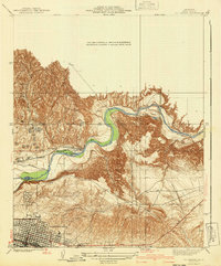
1940 Map of Oil Center
USGS Topo · Published 1940About this map
Oil production and water management dominate this portion of the southern San Joaquin Valley, where the Kern River carves through the terrain northeast of Bakersfield. The landscape is heavily marked by the infrastructure of the early 20th-century petroleum industry, centering on the eponymous settlement of Oil Center and nearby worker hubs like Oildale, Treadwell, and Volcan. Educational needs for these growing industrial communities are evidenced by the presence of Petroleum Sch and Azalea Sch.
Find a feature on this map
20 named features on this map. Tap any name to fly to it.
Don’t see what you’re looking for? This feature index may not catch every label — zoom into the map to look around manually.
Map Details
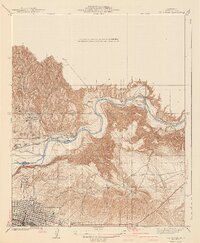
Editions of this 1940 Oil Center Map
2 editions found
Other maps of this area

1906 · Bakersfield
USGS Topo · 1:62,500

1910 · Buena Vista Lake
USGS Topo · 1:125,000

1912 · Buena Vista Lake
USGS Topo · 1:125,000

1914 · Caliente
USGS Topo · 1:125,000

1929 · Fairfax School
USGS Topo · 1:31,680

1930 · Oildale
USGS Topo · 1:31,680

1931 · Edison
USGS Topo · 1:31,680

1932 · North of Oildale
USGS Topo · 1:31,680

1932 · Fairfax School
USGS Topo · 1:31,680
1932 · Gosford
USGS Topo · 1:31,680