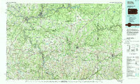
1983 Map of Oil City
USGS Topo · Published 1984About this map
The Allegheny River and Clarion River dominate this early 1980s landscape, winding through a region defined by its industrial heritage and extensive public lands. The map details the urban centers of Oil City and Franklin, where the confluence of French Creek and the Allegheny served as a historical hub for transport and resource extraction. The presence of numerous State Game Lands and the western edge of the Allegheny National Forest reflects a significant mid-century shift toward land conservation and managed recreation in the wake of the Pennsylvania oil boom.
Find a feature on this map
208 named features on this map. Tap any name to fly to it.
Don’t see what you’re looking for? This feature index may not catch every label — zoom into the map to look around manually.
Map Details
Editions of this 1983 Oil City Map
This is the sole edition of this map. No revisions or reprints were ever made.
Other maps of this area

1900 · Kittanning
USGS Topo · 1:62,500

1901 · Rural Valley
USGS Topo · 1:62,500

1902 · Kittanning
USGS Topo · 1:62,500

1903 · Rural Valley
USGS Topo · 1:62,500

1906 · Clarion
USGS Topo · 1:62,500

1906 · Punxsutawney
USGS Topo · 1:62,500

1907 · Clarion
USGS Topo · 1:62,500

1907 · Foxburg
USGS Topo · 1:62,500

1908 · Foxburg
USGS Topo · 1:62,500

1908 · Zelienople
USGS Topo · 1:62,500