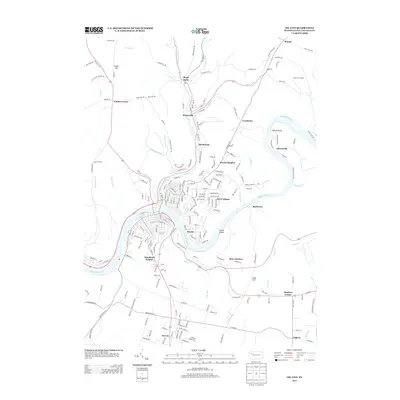
2013 Map of Oil City
USGS Topo · Published 2013About this map
The Allegheny River and Oil Cr anchor this 2013 geographic study of Venango County, where industrial history meets modern suburban expansion. The river winds past Alcorn Island and the community of Rockmere, while the creek valley hosts the established settlements of Rouseville and McClintock. These waterways have long dictated the development of the region, from early petroleum extraction sites like Rynd Farm to the more recent residential layouts of Hasson Heights and Oliver Manor.
Find a feature on this map
210 named features on this map. Tap any name to fly to it.
Don’t see what you’re looking for? This feature index may not catch every label — zoom into the map to look around manually.
Map Details
Editions of this 2013 Oil City Map
This is the sole edition of this map. No revisions or reprints were ever made.
Other maps of this area

1909 · Franklin
USGS Topo · 1:62,500

1911 · Franklin
USGS Topo · 1:62,500

1922 · Oil City
USGS Topo · 1:48,000

1924 · Oil City
USGS Topo · 1:62,500

1927 · Townville
USGS Topo · 1:48,000

1927 · Titusville
USGS Topo · 1:62,500

1932 · Townville
USGS Topo · 1:62,500

1933 · Titusville
USGS Topo · 1:62,500

1943 · Oil City
USGS Topo · 1:62,500

1945 · Townville
USGS Topo · 1:62,500