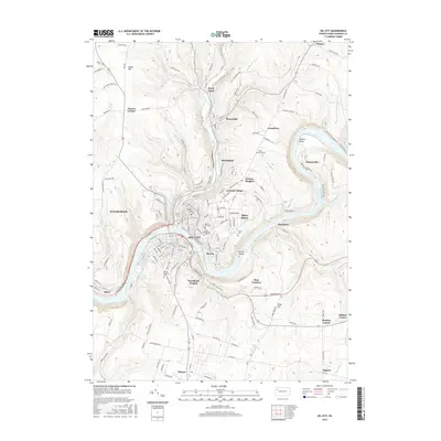
2016 Map of Oil City
USGS Topo · Published 2016About this map
Oil City and its surrounding industrial and residential outskirts are defined by the convergence of Oil Creek and the Allegheny River in this 2016 topographical survey. The landscape retains clear evidence of its petroleum heritage, noted by several Oil Seeps and a Tank Farm situated near Rouseville. Settlement patterns follow the river valleys and the winding path of the W & L E RR, which skirts the riverbanks near Siverly and Reno.
Find a feature on this map
159 named features on this map. Tap any name to fly to it.
Don’t see what you’re looking for? This feature index may not catch every label — zoom into the map to look around manually.
Map Details
Editions of this 2016 Oil City Map
This is the sole edition of this map. No revisions or reprints were ever made.
Other maps of this area

1909 · Franklin
USGS Topo · 1:62,500

1911 · Franklin
USGS Topo · 1:62,500

1922 · Oil City
USGS Topo · 1:48,000

1924 · Oil City
USGS Topo · 1:62,500

1927 · Townville
USGS Topo · 1:48,000

1927 · Titusville
USGS Topo · 1:62,500

1932 · Townville
USGS Topo · 1:62,500

1933 · Titusville
USGS Topo · 1:62,500

1943 · Oil City
USGS Topo · 1:62,500

1945 · Townville
USGS Topo · 1:62,500