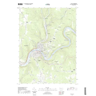
2019 Map of Oil City
USGS Topo · Published 2019About this map
Oil City sits at the confluence of Oil Creek and the Allegheny River, anchoring a region shaped by its deep industrial roots. The presence of Oil Seeps near Rynd Farm and Rouseville serves as a reminder of the Pennsylvania oil rush that defined these valleys. This modern survey shows the developed hillsides of Woodland Heights, Hasson Heights, and Siverly, while also documenting the institutional presence of Venango College - Clarion University and Du Bois Business College. Along the riverbanks, the Allegheny Wild and Scenic River winds past Alcorn Island toward settlements like Reno and Rockmere. For genealogists, the map is a detailed resource for local burials, locating numerous sites including Mount Pleasant Cem, Grove Hill Cem, and Calvary Cem, providing a precise geographic context for family histories within the Venango County landscape.
Find a feature on this map
165 named features on this map. Tap any name to fly to it.
Don’t see what you’re looking for? This feature index may not catch every label — zoom into the map to look around manually.
Map Details
Editions of this 2019 Oil City Map
This is the sole edition of this map. No revisions or reprints were ever made.
Other maps of this area

1909 · Franklin
USGS Topo · 1:62,500

1911 · Franklin
USGS Topo · 1:62,500

1922 · Oil City
USGS Topo · 1:48,000

1924 · Oil City
USGS Topo · 1:62,500

1927 · Townville
USGS Topo · 1:48,000

1927 · Titusville
USGS Topo · 1:62,500

1932 · Townville
USGS Topo · 1:62,500

1933 · Titusville
USGS Topo · 1:62,500

1943 · Oil City
USGS Topo · 1:62,500

1945 · Townville
USGS Topo · 1:62,500