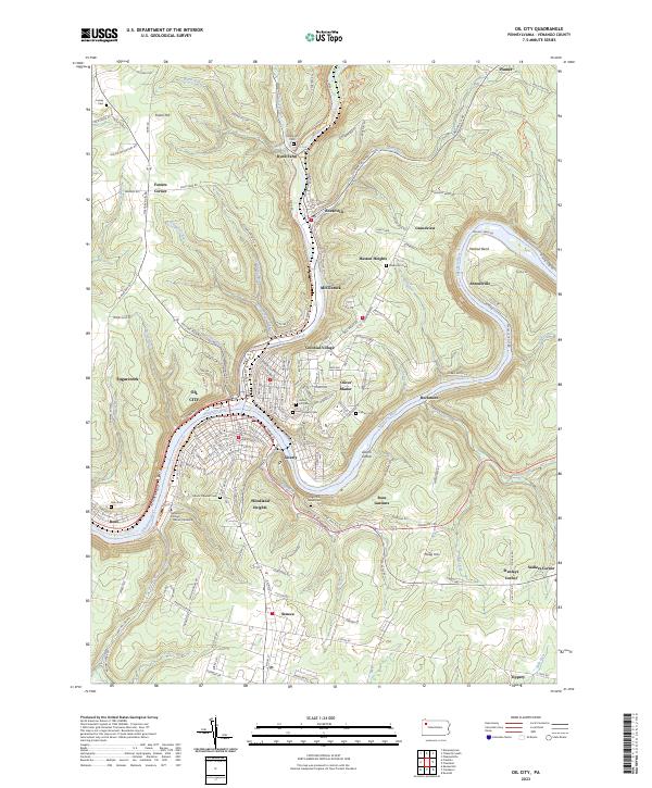
2023 Map of Oil City
USGS Topo · Published 2023About this map
Oil City sits at the confluence of Oil Creek and the Allegheny River, serving as a focal point in a landscape shaped by Pennsylvania's petroleum history. The terrain is marked by industrial roots, evidenced by the presence of Oil Seeps near Rynd Farm and the dense network of neighborhoods like Siverly, McClintock, and Rouseville that trace the water's edge. This modern survey illustrates the area's educational and social infrastructure, featuring the Venango College Clarion University campus and numerous historic burial grounds including Grove Hill Cem and the Sage Run Jewish Cem.
Find a feature on this map
182 named features on this map. Tap any name to fly to it.
Don’t see what you’re looking for? This feature index may not catch every label — zoom into the map to look around manually.
Map Details
Editions of this 2023 Oil City Map
This is the sole edition of this map. No revisions or reprints were ever made.
Other maps of this area

1909 · Franklin
USGS Topo · 1:62,500

1911 · Franklin
USGS Topo · 1:62,500

1922 · Oil City
USGS Topo · 1:48,000

1924 · Oil City
USGS Topo · 1:62,500

1927 · Townville
USGS Topo · 1:48,000

1927 · Titusville
USGS Topo · 1:62,500

1932 · Townville
USGS Topo · 1:62,500

1933 · Titusville
USGS Topo · 1:62,500

1943 · Oil City
USGS Topo · 1:62,500

1945 · Townville
USGS Topo · 1:62,500