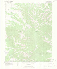
1967 Map of Ojito Peak
USGS Topo · Published 1971About this map
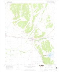
The Sangre De Cristo Grant in southern Colorado defines this high-elevation landscape, where the headwaters of several critical watercourses begin their descent. This 1960s survey captures a working mountain environment where natural drainage and human utility overlap. In the southern reach, the waters of Rito Seco flow near a small Mine and an old Corral, evidence of the area's mixed history of ranching and extraction. The northern terrain is dominated by the prominence of Ojito Peak and the deep cut of Squirrel Canyon. Water management is a visible priority on the sheet, from the Willow Creek Reservoir at the western edge to the Gaging Sta along North Fork Trinchera Creek. A network of Jeep Trails provides the primary access through the steep contours, connecting remote features like Big Meadow to the valley below.
Find a feature on this map
12 named features on this map. Tap any name to fly to it.
Don’t see what you’re looking for? This feature index may not catch every label — zoom into the map to look around manually.
Map Details
Editions of this 1967 Ojito Peak Map
4 editions found
Other maps of this area

1954 · Trinidad
USGS Topo · 1:250,000

1955 · Trinidad
USGS Topo · 1:250,000

1958 · Trinidad
USGS Topo · 1:250,000

1959 · Trinidad
USGS Topo · 1:250,000

1963 · Mc Carty Park
USGS Topo · 1:24,000

1967 · San Luis
USGS Topo · 1:24,000

1967 · Fort Garland SW
USGS Topo · 1:24,000

1967 · Ojito Peak
USGS Topo · 1:24,000
1967 · Trinchera Ranch
USGS Topo · 1:24,000
1967 · Fort Garland
USGS Topo · 1:24,000