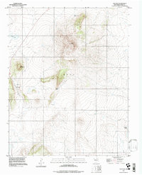
1994 Map of Ojo Feliz
USGS Topo · Published 1998About this map
The high-desert terrain of Mora County is defined here by dramatic volcanic and tectonic features, most notably the prominent rise of Cerro Pelon and the ridge of La Cuchilla. Small pockets of human settlement like Ojo Feliz and San Ysidro are situated near the Western edges of the quadrangle, where the landscape transitions into the rolling elevations of Cerro Del Amole. The presence of the Casias Cem and the Pelon Windmill indicates a history of localized ranching and family homesteading that relied on the area's scarce water sources.
Find a feature on this map
12 named features on this map. Tap any name to fly to it.
Don’t see what you’re looking for? This feature index may not catch every label — zoom into the map to look around manually.
Map Details
Editions of this 1994 Ojo Feliz Map
This is the sole edition of this map. No revisions or reprints were ever made.
Other maps of this area

1889 · Las Vegas
USGS Topo · 1:125,000

1891 · Las Vegas
USGS Topo · 1:125,000

1892 · Watrous
USGS Topo · 1:125,000

1893 · Las Vegas
USGS Topo · 1:125,000

1894 · Watrous
USGS Topo · 1:125,000

1954 · Santa Fe
USGS Topo · 1:250,000

1954 · Raton
USGS Topo · 1:250,000

1958 · Raton
USGS Topo · 1:250,000

1958 · Santa Fe
USGS Topo · 1:250,000

1963 · Fort Union
USGS Topo · 1:24,000