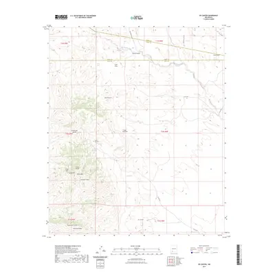
2023 Map of OK Canyon
USGS Topo · Published 2023About this map
Cookes Peak serves as a massive focal point in this high-altitude landscape where the borders of Sierra, Grant, and Luna counties converge. The rugged topography is defined by the Cookes Range, a prominent chain that creates a complex network of drainages including Montezuma Canyon and Ok Canyon. For local history researchers, the Cookes Peak Cem located near Riley Spring offers a quiet marker of early settlement or mining era activity in this arid environment. Water management is the primary key to the human footprint here, visible through the mapping of remote sources like Mule Springs, Shale Spring, and Burro Spring. Seasonal watercourses like Mule Springs Creek and China Draw carve through the foothills, illustrating how the natural terrain dictated the paths of early county roads.
Find a feature on this map
36 named features on this map. Tap any name to fly to it.
Don’t see what you’re looking for? This feature index may not catch every label — zoom into the map to look around manually.
Map Details
Editions of this 2023 OK Canyon Map
This is the sole edition of this map. No revisions or reprints were ever made.
Other maps of this area

1899 · Deming
USGS Topo · 1:125,000

1915 · Deming
USGS Topo · 1:125,000

1955 · Las Cruces
USGS Topo · 1:250,000

1956 · Dwyer
USGS Topo · 1:62,500

1958 · Las Cruces
USGS Topo · 1:250,000

1962 · Lake Valley
USGS Topo · 1:62,500

1964 · Goat Ridge
USGS Topo · 1:24,000

1964 · Florida
USGS Topo · 1:24,000

1964 · Massacre Peak
USGS Topo · 1:24,000

1982 · Hatch
USGS Topo · 1:100,000