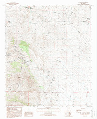
1989 Map of Ok Canyon
USGS Topo · Published 1989About this map
The Cookes Range dominates this corner of New Mexico, where the legacy of late-19th-century mining is etched into the rugged topography. This 1989 revision document records an intense density of prospecting activity, particularly around the Cooks Peak (Site) and the high slopes of Cookes Peak. Numerous Prospects, Mine Shafts, and Adits pepper the mountain flanks, indicating a landscape defined by mineral extraction rather than permanent settlement.
Find a feature on this map
33 named features on this map. Tap any name to fly to it.
Don’t see what you’re looking for? This feature index may not catch every label — zoom into the map to look around manually.
Map Details
Editions of this 1989 Ok Canyon Map
This is the sole edition of this map. No revisions or reprints were ever made.
Other maps of this area

1899 · Deming
USGS Topo · 1:125,000

1915 · Deming
USGS Topo · 1:125,000

1955 · Las Cruces
USGS Topo · 1:250,000

1956 · Dwyer
USGS Topo · 1:62,500

1958 · Las Cruces
USGS Topo · 1:250,000

1962 · Lake Valley
USGS Topo · 1:62,500

1964 · Goat Ridge
USGS Topo · 1:24,000

1964 · Florida
USGS Topo · 1:24,000

1964 · Massacre Peak
USGS Topo · 1:24,000

1982 · Hatch
USGS Topo · 1:100,000