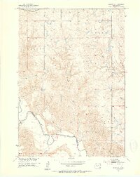
1951 Map of Okaton SE
USGS Topo · Published 1953About this map
The White River carves a significant course across this landscape at the border of Jones and Mellette counties. This mid-century survey captures a rural ranching and farming environment structured by the township system, featuring the Okaton and Murdo boundaries. The northern section is defined by the Chicago Milwaukee St Paul and Pacific railroad, which provided the primary industrial link for this prairie region.
Find a feature on this map
13 named features on this map. Tap any name to fly to it.
Don’t see what you’re looking for? This feature index may not catch every label — zoom into the map to look around manually.
Map Details
Editions of this 1951 Okaton SE Map
3 editions found
Other maps of this area

1951 · Okaton SW
USGS Topo · 1:24,000

1951 · Westover
USGS Topo · 1:24,000

1951 · Murdo SW
USGS Topo · 1:24,000

1951 · Murdo 3 NW
USGS Topo · 1:24,000

1951 · Murdo 3 NE
USGS Topo · 1:24,000

1951 · Okaton SE
USGS Topo · 1:24,000

1955 · Martin
USGS Topo · 1:250,000

1958 · Martin
USGS Topo · 1:250,000

1972 · Murdo
USGS Topo · 1:24,000

1972 · Okaton
USGS Topo · 1:24,000