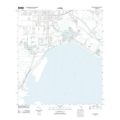
2012 Map of Okeechobee
USGS Topo · Published 2012About this map
Lake Okeechobee dominates the southern landscape of this Florida region, marking the convergence of critical waterways and early 19th-century history. The map highlights the historic Okeechobee Battlefield, a significant site reflecting the area's conflict-driven past. Along the northern shoreline, the modern town center is defined by an extensive grid of streets and residential developments, while the Taylor Cr and Nubbin Slough drainage systems channel water into the lake. In the western reaches, the Kissimmee River flows past the Okee Tantie Marina, indicating the importance of recreational and commercial water access. The settlement at Sherman and the Liveoak Park Memorial Cem provide key points for local history and genealogy, showcasing the expansion of infrastructure around the state's largest freshwater body.
Find a feature on this map
67 named features on this map. Tap any name to fly to it.
Don’t see what you’re looking for? This feature index may not catch every label — zoom into the map to look around manually.
Map Details
Editions of this 2012 Okeechobee Map
This is the sole edition of this map. No revisions or reprints were ever made.
Other maps of this area

1952 · Okeechobee NW
USGS Topo · 1:24,000

1952 · Okeechobee
USGS Topo · 1:24,000

1953 · Okeechobee 4 SW
USGS Topo · 1:24,000

1953 · Okeechobee SW
USGS Topo · 1:24,000

1953 · Okeechobee 4 NW
USGS Topo · 1:24,000

1953 · Taylor Creek SW
USGS Topo · 1:24,000

1953 · Okeechobee 1 SW
USGS Topo · 1:24,000

1953 · Taylor Creek SE
USGS Topo · 1:24,000

1956 · Fort Pierce
USGS Topo · 1:250,000

1958 · Fort Pierce
USGS Topo · 1:250,000