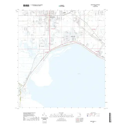
2021 Map of Okeechobee
USGS Topo · Published 2021About this map
Okeechobee serves as the hub of this South Florida landscape, where the town's grid meets the northern shores of Lake Okeechobee. The map documents a transition from the dense street network of the city center, including the Okeechobee County Judicial Center, to the outlying communities of Cypress Quarters and Taylor Creek. Significant water management features are evident where the Kissimmee River enters the lake at the southwestern corner, while Mosquito Creek and Lemkin Cr drain the surrounding lowlands. To the east, the settlement of Sherman sits near the rail line, marking the edge of more open terrain. Modern recreation and conservation are highlighted by the Florida National Scenic Trail, which follows the curve of the lake's levee, providing a continuous path through the wetlands and marshes of Eagle Bay.
Find a feature on this map
76 named features on this map. Tap any name to fly to it.
Don’t see what you’re looking for? This feature index may not catch every label — zoom into the map to look around manually.
Map Details
Editions of this 2021 Okeechobee Map
This is the sole edition of this map. No revisions or reprints were ever made.
Other maps of this area

1952 · Okeechobee NW
USGS Topo · 1:24,000

1952 · Okeechobee
USGS Topo · 1:24,000

1953 · Okeechobee 4 SW
USGS Topo · 1:24,000

1953 · Okeechobee SW
USGS Topo · 1:24,000

1953 · Okeechobee 4 NW
USGS Topo · 1:24,000

1953 · Taylor Creek SW
USGS Topo · 1:24,000

1953 · Okeechobee 1 SW
USGS Topo · 1:24,000

1953 · Taylor Creek SE
USGS Topo · 1:24,000

1956 · Fort Pierce
USGS Topo · 1:250,000

1958 · Fort Pierce
USGS Topo · 1:250,000