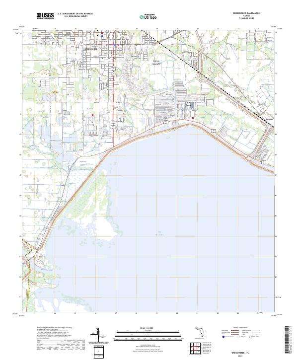
2024 Map of Okeechobee
USGS Topo · Published 2024About this map
Okeechobee sits at the northern apex of the state's largest freshwater lake, where the modern landscape reflects a century of water management and residential growth. This 2024 survey detail shows the convergence of the Kissimmee River and Taylor Creek as they enter Lake Okeechobee, illustrating the complex drainage network that defines the region. The city’s core is clearly mapped with its grid of streets such as Park St and NW 2nd St, extending toward the Okeechobee County Judicial Center. Surrounding the central town are distinct communities like Cypress Quarters and Sherman, along with the wetlands of Eagle Bay. The map captures the current state of this lakefront hub, tracing the transition from the dense urban center to the broad, marshy shores of the Big Water.
Find a feature on this map
83 named features on this map. Tap any name to fly to it.
Don’t see what you’re looking for? This feature index may not catch every label — zoom into the map to look around manually.
Map Details
Editions of this 2024 Okeechobee Map
This is the sole edition of this map. No revisions or reprints were ever made.
Other maps of this area

1952 · Okeechobee NW
USGS Topo · 1:24,000

1952 · Okeechobee
USGS Topo · 1:24,000

1953 · Okeechobee 4 SW
USGS Topo · 1:24,000

1953 · Okeechobee SW
USGS Topo · 1:24,000

1953 · Okeechobee 4 NW
USGS Topo · 1:24,000

1953 · Taylor Creek SW
USGS Topo · 1:24,000

1953 · Okeechobee 1 SW
USGS Topo · 1:24,000

1953 · Taylor Creek SE
USGS Topo · 1:24,000

1956 · Fort Pierce
USGS Topo · 1:250,000

1958 · Fort Pierce
USGS Topo · 1:250,000