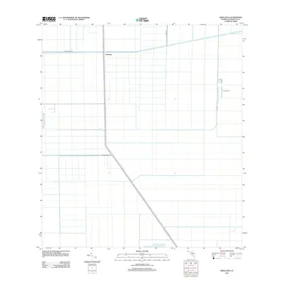
2012 Map of Okeelanta
USGS Topo · Published 2012About this map
Okeelanta serves as a central point in this landscape of the Florida Everglades, defined by a rigid grid of agricultural canals and access roads. The North New River Canal cuts a distinctive diagonal path across the southern half of the quadrangle, serving as a primary water management artery through the low-lying terrain. This 2012 survey illustrates the intensive engineering required to manage the wetlands for productive use, showing a highly organized system of drainage and transport. Landmarks such as the Duda Airstrip and Duda Rd indicate the industrial scale of local operations. Primary transit routes like Bolles Canal Rd and Willard Smith Rd follow the linear path of the drainage system, anchoring a landscape where water control and agriculture are inextricably linked.
Find a feature on this map
7 named features on this map. Tap any name to fly to it.
Don’t see what you’re looking for? This feature index may not catch every label — zoom into the map to look around manually.
Map Details
Editions of this 2012 Okeelanta Map
This is the sole edition of this map. No revisions or reprints were ever made.
Other maps of this area

1956 · West Palm Beach
USGS Topo · 1:250,000

1957 · West Palm Beach
USGS Topo · 1:250,000

1958 · West Palm Beach
USGS Topo · 1:250,000

1970 · Lake Harbor
USGS Topo · 1:24,000

1970 · Belle Glade
USGS Topo · 1:24,000

1970 · Lake Harbor SE
USGS Topo · 1:24,000

1970 · Okeelanta
USGS Topo · 1:24,000

1970 · Shawano
USGS Topo · 1:24,000

1970 · Sixmile Bend
USGS Topo · 1:24,000

1974 · Everglades 1 NW
USGS Topo · 1:24,000