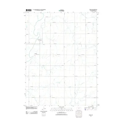
2012 Map of Oketo
USGS Topo · Published 2012About this map
The Big Blue River anchors the western edge of this Marshall County landscape, where the small settlement of Marietta sits just east of the river's winding course. The terrain is defined by a dense network of drainage, with numerous tributaries such as N Elm Cr, Scotch Cr, and Bommer Cr carving through the agricultural sections. A post office Po serves the northern portion of the quadrangle near the intersection of Mill St and E St, while the local history of the area is preserved at Oketo Cem and N Elm Cem. The map reveals a strictly organized grid of rural roads, including Cherokee Rd and Frontier Rd, which facilitate movement between the various creek basins and small farmsteads that characterize this part of northern Kansas.
Find a feature on this map
31 named features on this map. Tap any name to fly to it.
Don’t see what you’re looking for? This feature index may not catch every label — zoom into the map to look around manually.
Map Details
Editions of this 2012 Oketo Map
This is the sole edition of this map. No revisions or reprints were ever made.
Other maps of this area

1889 · Seneca
USGS Topo · 1:125,000

1889 · Marysville
USGS Topo · 1:125,000

1894 · Seneca
USGS Topo · 1:125,000

1894 · Marysville
USGS Topo · 1:125,000

1955 · Manhattan
USGS Topo · 1:250,000

1955 · Lincoln
USGS Topo · 1:250,000

1956 · Manhattan
USGS Topo · 1:250,000

1957 · Manhattan
USGS Topo · 1:250,000

1957 · Lincoln
USGS Topo · 1:250,000

1958 · Lincoln
USGS Topo · 1:250,000