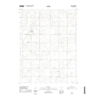
2018 Map of Oketo
USGS Topo · Published 2018About this map
Oketo and Marietta anchor this portion of northern Marshall County, situated along the banks and western bluffs of the Big Blue River. The landscape is defined by a dense network of creek drainages that carve through the prairie, including Mission Cr and N Elm Cr in the north, and Scotch Cr and Blodgett Cr further south. This drainage pattern highlights the topography of the region, where numerous small tributaries like Lily Cr and Spring Cr feed into the primary river valley.
Find a feature on this map
25 named features on this map. Tap any name to fly to it.
Don’t see what you’re looking for? This feature index may not catch every label — zoom into the map to look around manually.
Map Details
Editions of this 2018 Oketo Map
This is the sole edition of this map. No revisions or reprints were ever made.
Other maps of this area
1889 · Seneca
USGS Topo · 1:125,000
1889 · Marysville
USGS Topo · 1:125,000
1894 · Seneca
USGS Topo · 1:125,000
1894 · Marysville
USGS Topo · 1:125,000

1955 · Manhattan
USGS Topo · 1:250,000
1955 · Lincoln
USGS Topo · 1:250,000
1956 · Manhattan
USGS Topo · 1:250,000
1957 · Manhattan
USGS Topo · 1:250,000
1957 · Lincoln
USGS Topo · 1:250,000
1958 · Lincoln
USGS Topo · 1:250,000