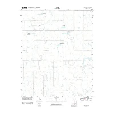
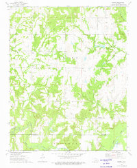
2010 Map of Okfuskee
USGS Topo · Published 2010About this map
Okfuskee Cemetery stands as a central historical landmark in this part of Okfuskee County, situated near the headwaters of Nuyaka Creek. The landscape is defined by a sophisticated water management system developed by the U.S. Geological Survey and related agencies, evidenced by the numerous reservoirs and dams that dot the terrain. These include the Oknoname 107033 Reservoir in the north and a series of specialized sites like Okfuskee Tributaries Site N-10 Reservoir.
Find a feature on this map
38 named features on this map. Tap any name to fly to it.
Don’t see what you’re looking for? This feature index may not catch every label — zoom into the map to look around manually.
Map Details
Editions of this 2010 Okfuskee Map
This is the sole edition of this map. No revisions or reprints were ever made.
Other maps of this area

1900 · Wewoka
USGS Topo · 1:125,000

1901 · Nuyaka
USGS Topo · 1:125,000

1954 · Oklahoma City
USGS Topo · 1:250,000

1957 · Oklahoma City
USGS Topo · 1:250,000

1963 · Oklahoma City
USGS Topo · 1:250,000
1967 · Pharoah
USGS Topo · 1:24,000

1967 · Okemah
USGS Topo · 1:24,000
1967 · Clearview
USGS Topo · 1:24,000
1973 · Nuyaka
USGS Topo · 1:24,000
1973 · Newby
USGS Topo · 1:24,000