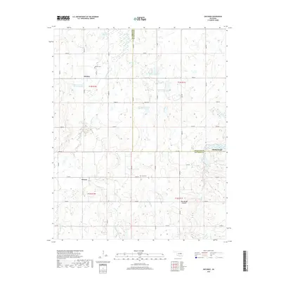
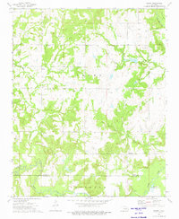
2018 Map of Okfuskee
USGS Topo · Published 2018About this map
Okfuskee and Oriental anchor this portion of the Oklahoma landscape, where the border between Okfuskee and Okmulgee counties bisects a network of creek drainages and modern rural roads. The area is defined by its water management systems, including the Okfuskee Tributaries Site N-1 Reservoir and the Salt Creek Site S-1 Reservoir, reflecting a territory heavily shaped by flood control and agricultural water storage. Genealogy and local history researchers will find the locations of Okfuskee Cem and Nuyaka Cem particularly useful, as they mark the centers of historical community life alongside established crossroads like Woodard Corner. The terrain is etched by numerous watercourses such as Sixshooter Cr, Cow Cr, and Nuyaka Cr, which wind through a landscape that transitioned from original allotments to the rural residential and agricultural patterns visible in the late 2010s.
Find a feature on this map
44 named features on this map. Tap any name to fly to it.
Don’t see what you’re looking for? This feature index may not catch every label — zoom into the map to look around manually.
Map Details
Editions of this 2018 Okfuskee Map
This is the sole edition of this map. No revisions or reprints were ever made.
Other maps of this area

1900 · Wewoka
USGS Topo · 1:125,000

1901 · Nuyaka
USGS Topo · 1:125,000

1954 · Oklahoma City
USGS Topo · 1:250,000

1957 · Oklahoma City
USGS Topo · 1:250,000

1963 · Oklahoma City
USGS Topo · 1:250,000
1967 · Pharoah
USGS Topo · 1:24,000

1967 · Okemah
USGS Topo · 1:24,000
1967 · Clearview
USGS Topo · 1:24,000
1973 · Nuyaka
USGS Topo · 1:24,000
1973 · Newby
USGS Topo · 1:24,000