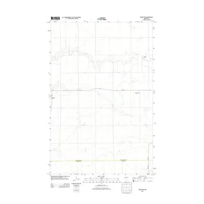
2013 Map of Oklee SW
USGS Topo · Published 2013About this map
Brooks sits at the western edge of this agricultural landscape in northwestern Minnesota, where the drainage of Brooks Cr meets the larger systems of the Hill River and Lost River. The map captures the organized grid of rural life, anchored by the Saint Francis Xavier Cem in the northeast. This area, spanning the boundary between Red Lake County and Polk County, is defined by its watercourses which cut meandering paths through the flat terrain. Local transit and commerce are facilitated by Mn-92, while specialized landmarks like the Oklee Racetrack reflect the social and recreational fabric of the community. The presence of well-established roads like Co Hwy-8 and 280th Ave SE illustrates a landscape fully integrated into the regional farming economy.
Find a feature on this map
10 named features on this map. Tap any name to fly to it.
Don’t see what you’re looking for? This feature index may not catch every label — zoom into the map to look around manually.
Map Details
Editions of this 2013 Oklee SW Map
This is the sole edition of this map. No revisions or reprints were ever made.
Other maps of this area

1918 · Terrebonne
USGS Topo · 1:62,500

1919 · Grit
USGS Topo · 1:62,500

1919 · Valley
USGS Topo · 1:62,500

1952 · Grand Forks
USGS Topo · 1:250,000

1954 · Bemidji
USGS Topo · 1:250,000

1956 · Grand Forks
USGS Topo · 1:250,000

1957 · Bemidji
USGS Topo · 1:250,000

1958 · Bemidji
USGS Topo · 1:250,000
1964 · Plummer
USGS Topo · 1:24,000

1964 · Brooks
USGS Topo · 1:24,000