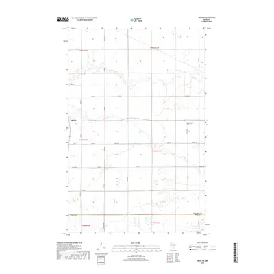
2019 Map of Oklee SW
USGS Topo · Published 2019About this map
Brooks is the primary settlement on this agricultural landscape in northwestern Minnesota, situated at the confluence of the Hill River and Brooks Cr. The town’s spatial layout is defined by the intersection of several county roads and the nearby watercourses, reflecting a typical Midwestern rail-and-river service hub. To the east, the Saint Francis Xavier Cem serves as a significant landmark for family history and local genealogical research. The northern portion of the quadrangle is bisected by the Lost River, which meanders through the plains. The southern border marks the division between Red Lake Co and Polk Co, showing the precise municipal boundaries that continue to shape local governance and land ownership in the region.
Find a feature on this map
35 named features on this map. Tap any name to fly to it.
Don’t see what you’re looking for? This feature index may not catch every label — zoom into the map to look around manually.
Map Details
Editions of this 2019 Oklee SW Map
This is the sole edition of this map. No revisions or reprints were ever made.
Other maps of this area

1918 · Terrebonne
USGS Topo · 1:62,500

1919 · Grit
USGS Topo · 1:62,500

1919 · Valley
USGS Topo · 1:62,500

1952 · Grand Forks
USGS Topo · 1:250,000

1954 · Bemidji
USGS Topo · 1:250,000

1956 · Grand Forks
USGS Topo · 1:250,000

1957 · Bemidji
USGS Topo · 1:250,000

1958 · Bemidji
USGS Topo · 1:250,000
1964 · Plummer
USGS Topo · 1:24,000

1964 · Brooks
USGS Topo · 1:24,000