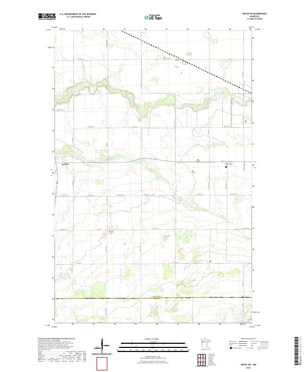
2022 Map of Oklee SW
USGS Topo · Published 2022About this map
Brooks stands as the primary settlement in this corner of Red Lake County, situated near the winding course of the Hill River. The landscape is defined by the drainage patterns of the Lost River to the north and Brooks Cr to the south, reflecting the flat, water-rich terrain of northwestern Minnesota. An orderly grid of section lines and county roads, such as Co Hwy 21 and Co Hwy 7, organizes the rural space, which transitions into Polk County at the southern boundary. Cultural markers like the Saint Francis Xavier Cem provide specific points of interest for genealogists tracing local families. The map illustrates a contemporary rural environment where agriculture and natural watercourses dictate the placement of roads and homesteads, offering a clear view of the region's modern infrastructure and geography.
Find a feature on this map
35 named features on this map. Tap any name to fly to it.
Don’t see what you’re looking for? This feature index may not catch every label — zoom into the map to look around manually.
Map Details
Editions of this 2022 Oklee SW Map
This is the sole edition of this map. No revisions or reprints were ever made.
Other maps of this area

1918 · Terrebonne
USGS Topo · 1:62,500

1919 · Grit
USGS Topo · 1:62,500

1919 · Valley
USGS Topo · 1:62,500

1952 · Grand Forks
USGS Topo · 1:250,000

1954 · Bemidji
USGS Topo · 1:250,000

1956 · Grand Forks
USGS Topo · 1:250,000

1957 · Bemidji
USGS Topo · 1:250,000

1958 · Bemidji
USGS Topo · 1:250,000
1964 · Plummer
USGS Topo · 1:24,000

1964 · Brooks
USGS Topo · 1:24,000