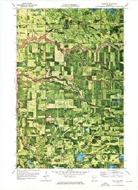
1971 Map of Oklee SW
USGS Topo · Published 1976About this map
Emardville and Garnes townships define this northwestern Minnesota landscape as it appeared in the early 1970s. This orthophotomap combines aerial photography with topographic contours, revealing a patchwork of agricultural fields and windbreaks characteristic of Red Lake County. The Soo Line railroad cuts diagonally through the northern sections, while the community of Brooks serves as a small hub for the surrounding rural homesteads. Three distinct waterways—the Lost River, Hill River, and Poplar River—meander across the terrain, their wooded banks contrasting sharply with the geometric precision of the surrounding farms.
Find a feature on this map
15 named features on this map. Tap any name to fly to it.
Don’t see what you’re looking for? This feature index may not catch every label — zoom into the map to look around manually.
Map Details
Editions of this 1971 Oklee SW Map
This is the sole edition of this map. No revisions or reprints were ever made.
Other maps of this area

1918 · Terrebonne
USGS Topo · 1:62,500

1919 · Grit
USGS Topo · 1:62,500

1919 · Valley
USGS Topo · 1:62,500

1952 · Grand Forks
USGS Topo · 1:250,000

1954 · Bemidji
USGS Topo · 1:250,000

1956 · Grand Forks
USGS Topo · 1:250,000

1957 · Bemidji
USGS Topo · 1:250,000

1958 · Bemidji
USGS Topo · 1:250,000
1964 · Plummer
USGS Topo · 1:24,000

1964 · Brooks
USGS Topo · 1:24,000