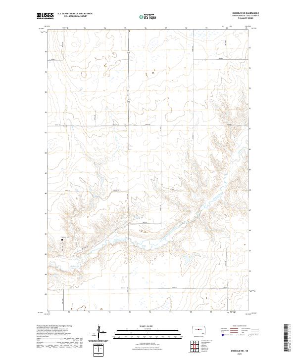
2021 Map of Okobojo NE
USGS Topo · Published 2021About this map
Okobojo Creek winds through the central and southern sections of this Sully County landscape, carving a distinct valley through the prairie. The topography is defined by the drainage patterns of this waterway and its smaller tributary, Okobojo Cr, which flows in from the northeast. Settlement in this portion of South Dakota is sparse, characterized by a grid of rural roads including Onida Rd and Stewart Rd. A significant point for local history and genealogy is the Okobojo Cem, located along Cemetery Rd on the western edge of the creek's valley. This survey illustrates the modern layout of township and range lines, such as t114n r79w, which continue to dictate the land use and property boundaries in this agricultural region.
Find a feature on this map
18 named features on this map. Tap any name to fly to it.
Don’t see what you’re looking for? This feature index may not catch every label — zoom into the map to look around manually.
Map Details
Editions of this 2021 Okobojo NE Map
This is the sole edition of this map. No revisions or reprints were ever made.
Other maps of this area

1954 · Pierre
USGS Topo · 1:250,000

1958 · Pierre
USGS Topo · 1:250,000

1965 · Artichoke Butte
USGS Topo · 1:24,000

1965 · Agar SW
USGS Topo · 1:24,000

1965 · Okobojo NE
USGS Topo · 1:24,000

1965 · Artichoke Butte SW
USGS Topo · 1:24,000

1965 · Okobojo
USGS Topo · 1:24,000

1965 · Sully Lake
USGS Topo · 1:24,000

1967 · Onida SW
USGS Topo · 1:24,000
1967 · Okobojo SE
USGS Topo · 1:24,000