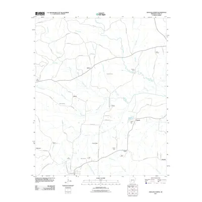
2011 Map of Okolona North
USGS Topo · Published 2011About this map
The rural landscape north of Okolona in Clark County is defined by the winding course of Terre Noire Creek and its many tributaries, including Moores Creek and Pruitt Creek. This 2011 survey reveals a quiet agricultural and timber-land character, dotted with small crossroads settlements such as Halfway, Smyrna, and Bethel. For those researching family history, the map is a dense record of early local burial sites, featuring Wimbley Cemetery, Ebenezer Cemetery, and the Wier Cemetery near the south edge. Modern infrastructure and historical transit markers appear side-by-side, from the Okolona Lookout Tower to the rail siding at Kathleen Siding. Near the center of the sheet, the Davidson Camp and nearby Davidson Campground Rd suggest the enduring importance of community and religious gathering spaces in this part of Arkansas.
Find a feature on this map
66 named features on this map. Tap any name to fly to it.
Don’t see what you’re looking for? This feature index may not catch every label — zoom into the map to look around manually.
Map Details
Editions of this 2011 Okolona North Map
This is the sole edition of this map. No revisions or reprints were ever made.
Other maps of this area

1901 · Gurdon
USGS Topo · 1:125,000

1943 · Antoine
USGS Topo · 1:62,500

1953 · El Dorado
USGS Topo · 1:250,000

1955 · Little Rock
USGS Topo · 1:250,000

1956 · Little Rock
USGS Topo · 1:250,000

1957 · El Dorado
USGS Topo · 1:250,000

1958 · El Dorado
USGS Topo · 1:250,000

1960 · El Dorado
USGS Topo · 1:250,000

1960 · Little Rock
USGS Topo · 1:250,000

1964 · Little Rock
USGS Topo · 1:250,000