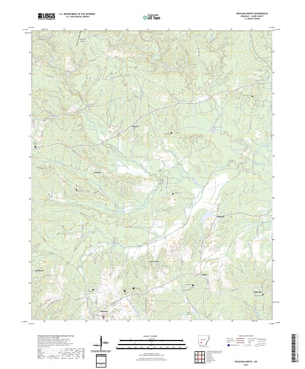
2024 Map of Okolona North
USGS Topo · Published 2024About this map
Okolona anchors the southern edge of this Clark County landscape, where the South Fork Terre Noire Creek and Pruitt Creek wind through the terrain. The area is defined by a dense network of small settlements and family landmarks, including Halfway, Smyrna, Boswell, and Dobyville. This territory is particularly significant for genealogical research, as it preserves the locations of numerous community burial grounds such as Wimbley Cem, Ebenezer Cem, and Clear Springs Cem. Local aviation history is noted by Ashworth Airport in the northern reaches, while the Bethel Church serves as a focal point for the settlement at Bethel. The map details a complex system of county roads and trails, such as Hignite Trl and Shaw Trl, that connect these rural Arkansas communities.
Find a feature on this map
70 named features on this map. Tap any name to fly to it.
Don’t see what you’re looking for? This feature index may not catch every label — zoom into the map to look around manually.
Map Details
Editions of this 2024 Okolona North Map
This is the sole edition of this map. No revisions or reprints were ever made.
Other maps of this area

1901 · Gurdon
USGS Topo · 1:125,000

1943 · Antoine
USGS Topo · 1:62,500

1953 · El Dorado
USGS Topo · 1:250,000

1955 · Little Rock
USGS Topo · 1:250,000

1956 · Little Rock
USGS Topo · 1:250,000

1957 · El Dorado
USGS Topo · 1:250,000

1958 · El Dorado
USGS Topo · 1:250,000

1960 · El Dorado
USGS Topo · 1:250,000

1960 · Little Rock
USGS Topo · 1:250,000

1964 · Little Rock
USGS Topo · 1:250,000