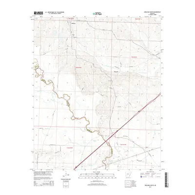
2014 Map of Okolona South
USGS Topo · Published 2014About this map
The town of Okolona anchors this rural landscape, situated just north of where several creek systems converge. This survey details the transition between the rolling uplands and the river bottoms, marked by the winding path of the Little Missouri River and its associated wetlands, including Grassy Lake, Half Moon Slough, and Beaver Slough. The settlement at Burtsell appears further east, connected by a network of local roads such as McNabb Rd and Dickerson Rd. For genealogists, the map is a vital resource for locating the Okolona Cem, as well as the Rome Cem and Old Rome Cem near the river. Significant water bodies like the S Fork Terre Noire Cr and Pruitt Cr define the drainage patterns of the region, illustrating the agricultural and geographical layout of the Clark County and Nevada County borderlands.
Find a feature on this map
50 named features on this map. Tap any name to fly to it.
Don’t see what you’re looking for? This feature index may not catch every label — zoom into the map to look around manually.
Map Details
Editions of this 2014 Okolona South Map
This is the sole edition of this map. No revisions or reprints were ever made.
Other maps of this area

1901 · Gurdon
USGS Topo · 1:125,000

1943 · Antoine
USGS Topo · 1:62,500

1953 · El Dorado
USGS Topo · 1:250,000

1955 · Little Rock
USGS Topo · 1:250,000

1956 · Little Rock
USGS Topo · 1:250,000

1957 · El Dorado
USGS Topo · 1:250,000

1958 · El Dorado
USGS Topo · 1:250,000

1960 · El Dorado
USGS Topo · 1:250,000

1960 · Little Rock
USGS Topo · 1:250,000

1964 · Little Rock
USGS Topo · 1:250,000