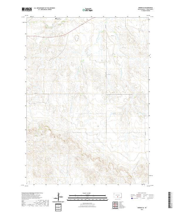
2021 Map of Okreek SE
USGS Topo · Published 2021About this map
Saint Peter's Catholic Cem stands as a significant cultural landmark in the northern reaches of this Todd County landscape. The terrain is defined by the drainage patterns of several seasonal watercourses, including Oak Cr and the diverging branches of W White Horse Cr and E White Horse Cr. These creeks carve through the prairie, shaping the local topography and influencing the placement of rural infrastructure like Happy Valley Rd.
Find a feature on this map
15 named features on this map. Tap any name to fly to it.
Don’t see what you’re looking for? This feature index may not catch every label — zoom into the map to look around manually.
Map Details
Editions of this 2021 Okreek SE Map
This is the sole edition of this map. No revisions or reprints were ever made.
Other maps of this area

1955 · Martin
USGS Topo · 1:250,000

1958 · Martin
USGS Topo · 1:250,000

1982 · Hidden Timber
USGS Topo · 1:24,000

1982 · Okreek
USGS Topo · 1:25,000

1982 · Witten SW
USGS Topo · 1:25,000

1982 · Okreek SE
USGS Topo · 1:24,000
1982 · Keyapaha NW
USGS Topo · 1:24,000
1982 · Carter
USGS Topo · 1:25,000

1982 · Mosher
USGS Topo · 1:25,000
1982 · Hidden Timber NE
USGS Topo · 1:24,000